


Deschutes County PUMA, Oregon
About
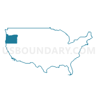
Outline

Summary
| Unique Area Identifier | 193815 |
| Name | Deschutes County PUMA |
| State | Oregon |
| Area (square miles) | 3,054.77 |
| Land Area (square miles) | 3,018.19 |
| Water Area (square miles) | 36.58 |
| % of Land Area | 98.80 |
| % of Water Area | 1.20 |
| Latitude of the Internal Point | 43.91511810 |
| Longtitude of the Internal Point | -121.22557510 |
Maps

Graphs
Select a template below for downloading or customizing gragh for Deschutes County PUMA, Oregon


Neighbors
Neighoring Public Use Microdata Area (by Name) Neighboring Public Use Microdata Area on the Map
- Klamath, Malheur, Lake & Harney Counties PUMA, OR
- Lane County (Outside Eugene & Springfield Cities) PUMA, OR
- Linn & Benton Counties PUMA, OR
- North Central Oregon--The Dalles City PUMA, OR
Top 10 Neighboring County (by Population) Neighboring County on the Map
- Lane County, OR (351,715)
- Deschutes County, OR (157,733)
- Linn County, OR (116,672)
- Klamath County, OR (66,380)
- Jefferson County, OR (21,720)
- Crook County, OR (20,978)
- Lake County, OR (7,895)
- Harney County, OR (7,422)
Top 10 Neighboring County Subdivision (by Population) Neighboring County Subdivision on the Map
- Bend CCD, Deschutes County, OR (87,281)
- Redmond CCD, Deschutes County, OR (35,941)
- Sisters-Millican CCD, Deschutes County, OR (27,974)
- Culver CCD, Jefferson County, OR (7,153)
- Tumalo CCD, Deschutes County, OR (6,537)
- Burns CCD, Harney County, OR (5,281)
- McKenzie River CCD, Lane County, OR (5,187)
- Oakridge CCD, Lane County, OR (4,478)
- Crooked River CCD, Crook County, OR (3,877)
- Crescent Lake CCD, Klamath County, OR (3,038)
Top 10 Neighboring Place (by Population) Neighboring Place on the Map
- Bend city, OR (76,639)
- Redmond city, OR (26,215)
- Deschutes River Woods CDP, OR (5,077)
- Three Rivers CDP, OR (3,014)
- Sisters city, OR (2,038)
- Eagle Crest CDP, OR (1,696)
- La Pine city, OR (1,653)
- Sunriver CDP, OR (1,393)
- Terrebonne CDP, OR (1,257)
- Tumalo CDP, OR (488)
Top 10 Neighboring Elementary School District (by Population) Neighboring Elementary School District on the Map
Top 10 Neighboring Secondary School District (by Population) Neighboring Secondary School District on the Map
Top 10 Neighboring Unified School District (by Population) Neighboring Unified School District on the Map
- Bend-La Pine Administrative School District 1, OR (107,386)
- Redmond School District 2J, OR (45,507)
- Klamath County School District, OR (42,784)
- Crook County School District, OR (21,037)
- Sweet Home School District 55, OR (14,649)
- Sisters School District 6, OR (7,596)
- Oakridge School District 76, OR (4,474)
- Culver School District 4, OR (3,502)
- McKenzie School District 68, OR (2,265)
- North Lake School District 14, OR (1,998)
Top 10 Neighboring State Legislative District Lower Chamber (by Population) Neighboring State Legislative District Lower Chamber on the Map
- State House District 54, OR (81,809)
- State House District 53, OR (73,781)
- State House District 55, OR (66,629)
- State House District 17, OR (61,383)
- State House District 59, OR (60,455)
- State House District 7, OR (59,574)
- State House District 60, OR (55,458)
Top 10 Neighboring State Legislative District Upper Chamber (by Population) Neighboring State Legislative District Upper Chamber on the Map
- State Senate District 27, OR (155,590)
- State Senate District 28, OR (125,860)
- State Senate District 9, OR (123,674)
- State Senate District 4, OR (122,124)
- State Senate District 30, OR (115,913)
Top 10 Neighboring 111th Congressional District (by Population) Neighboring 111th Congressional District on the Map
Top 10 Neighboring Census Tract (by Population) Neighboring Census Tract on the Map
- Census Tract 10.01, Deschutes County, OR (12,537)
- Census Tract 21, Deschutes County, OR (11,149)
- Census Tract 13, Deschutes County, OR (10,806)
- Census Tract 11, Deschutes County, OR (10,254)
- Census Tract 19.02, Deschutes County, OR (8,205)
- Census Tract 3, Deschutes County, OR (7,968)
- Census Tract 7, Deschutes County, OR (7,670)
- Census Tract 18, Deschutes County, OR (7,637)
- Census Tract 17, Deschutes County, OR (7,550)
- Census Tract 20, Deschutes County, OR (7,002)
Top 10 Neighboring 5-Digit ZIP Code Tabulation Area (by Population) Neighboring 5-Digit ZIP Code Tabulation Area on the Map
- 97701, OR (58,993)
- 97702, OR (40,583)
- 97756, OR (33,554)
- 97754, OR (18,574)
- 97739, OR (11,018)
- 97760, OR (6,757)
- 97759, OR (6,294)
- 97707, OR (5,814)
- 97734, OR (2,786)
- 97753, OR (2,016)